
Broch of Gurness against the Eynhallow Sound -
Rousay Island in the background
Day 14
Mine Howe - south-east of Kirkwall
"Mine Howe ... may have been considered sacred since the Neolithic period (between 4,000 and 2,500 BC) or earlier, but the style of the construction is very reminiscent of the Iron Age (between 700 BC and 500 AD)." (Mine Howe, The mystery of the 29 steps - Tankerness, Orkney)
"Mine Howe has been causing something of a stir in Orkney since its rediscovery in September 1999. The mound had been opened up once before in 1946 but was then abandoned and covered over for 53 years. Farmer Douglas Patterson re-opened the mound and a curious structure was excavated." Mine Howe - Mainland, Orkney
Subterranean Passages - (Ancient Sites Directory)
 |
 |
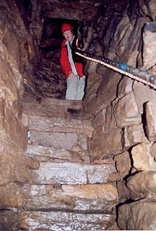
| The narrow shaft where you walk down a steep set of uneven steps to the chamber at the bottom. There are several theories as to the purpose of this deep well and "it is possible that Mine Howe was in some way associated with ritual or religion." (Mine Howe, The mystery of the 29 steps) | We had an archeological
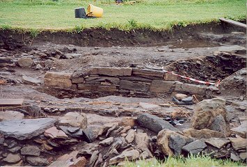
tour of Mine Howe and the new digs that are
under way here. A sizeable group of people were attending the tour,
likely attracted to the site partly because a skeleton had been
excavated just two weeks before we were
there.
This new find had made big headlines in the local newspapers and all
over England. |
Broch of Gurness on the Eynhallow Sound
After Mine Howe we drove north to the Broch of Gurness on the Eynhallow Sound. "The classic definition of a broch is a tall drystone tower, circular and tapering in its diameter as it rises; ... there is a single entrance and no windows."
They were built typically in the late Bronze Age or Iron Age. Their apparently defensive architecture is often considered to indicate a need for these people to defend themselves against invaders from the outside or from each other. "The word broch comes from the old Norse term for a fortification, 'borg', which implies that many were in reasonable shape in Viking times." ... "Brochs are unique to Scotland, particularly to western and northern Scotland where they must have dominated the landscape. They conform so closely in design that it has been suggested that they were the work of master craftsmen who travelled round undertaking commissions from eminent households who chose to signal their wealth and status by having a broch built." (Quote from 'Prehistoric Orkney' by Anna Ritchie - Historic Scotland.)
"On an exposed headland of Aikerness, you'll find the Broch of Gurness, an Iron-Age stone tower with walls still standing to 4m despite 2000 years of coastal erosion. ...This is certainly the best preserved broch in Orkney and the main tower is surrounded by the remains of a number of well-preserved outhouses. ...The visitors centre has some interesting displays on the culture that built these remarkable fortifications." (Scotland's Highlands and Islands - Lonely Planet Publications)

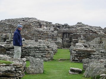
"Excavation
took place from 1929, and lasted for several years. ... At some date
between 500 BC an 200 BC... a decision was taken to create a new
settlement at Gurness. ...Towars the western side of the enclosed
paltform work began on a circular broch tower, 20m in external diameter
and perhaps 8 to 10m tall, while around it constructrion began on a
settlement of small stone houses with attached yards and storage
sheds." (The Brochs of Gurness and Midhowe - Historic Scotland)
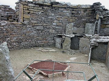
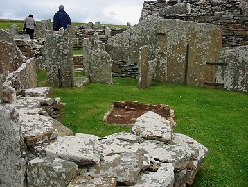
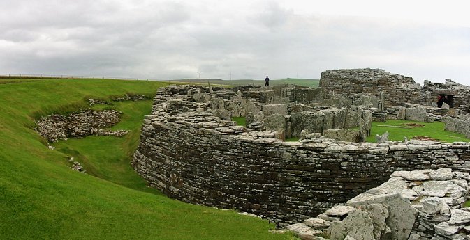
You can see
clearly the remains of the stone tower that made up the
center of this broch with the surrounding houses and ditches.
 |
 |
| In the evening on our way back from the Broch of Gurness, we made a second visit to the Ring of Brodgar, to see the enthralling sight once more. | One
of
the most majestic stones at the Ring of Brodgar with
the Loch of
Stenness in the background. This is the stone that
"was split in two
by a bolt of lightning" - well, some time ago.
|
Day 15
We drove from Stromness, via Kirkwall and southwards across Burray Island to South Ronaldsay Island and St. Margaret's Hope, a delightful village with picturesque stone houses. "St. Margaret's Hope has a post office, two grocery stores and several friendly pubs". (Scotland's Highlands and Islands) It also had a friendly tea room where we had scones and 'a nice cup of tea'.

Crossing over from Mainland to Burray we saw this shipwreck, most likely a relic from WWII.
Was it left there as a reminder?
"The Churchill Barriers were ordered to be built by Churchill in 1940 after the sinking of HMS Royal Oak in 1939, to seal off the eastern approaches to Scapa Flow."
(A Souvenir Guide to Orkney by Charles Tait)
We passed close to the edge of several small islands surrounding the half-way closed in sea called Scapa Flow (probably the island of Flotta here). This was the area that was barred off by the Churchill Barriers for German warships during the war.
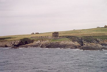
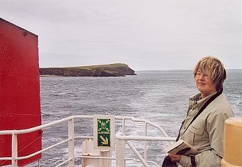
One of the small islands
surrounding
the
half-way
Wind-blown Siv at the stern of the
ferry
closed in sea called Scapa
Flow, which formed
part of the Churchill Barriers during the war.
part of the Churchill Barriers during the war.
We landed at Gills Bay and drove in very bad weather along the east coast of northern Scotland back to Inverness, through the city and on to Westhill where we had reserved a room at a B&B for our last night in Scotland. It turned out to be something like a modern-day mansion, a wonderfully beautiful and comfortable house which we will most likely return to another year.
Day 16
Balnuaran of Clava - Clava Cairns
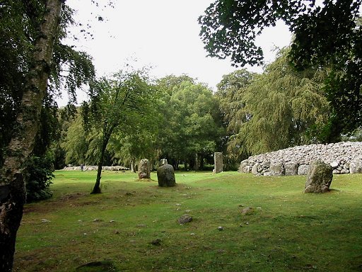
The North-east Passage Grave and the Ring Cairn on the left and farther back.
On our way to Inverness
airport we made a side trip to the Clava Cairns, east of Inverness
(close to the the
Culloden battlefield site, a totally different
story which we had to skip for lack of time). This is a Bronze Age
group
of cairns and stones - three to four thousand years old.
It was a rainy day but we managed nevertheless to take some pictures between the rain drops. Each cairn was accompanied by its historical-information table.
It was a rainy day but we managed nevertheless to take some pictures between the rain drops. Each cairn was accompanied by its historical-information table.
 |
 |
| "The monuments here were built between
three and four thousand years ago. The oldest are a circular walled enclosure - the central 'ring cairn' and two 'passage graves'? The latest was a ring of boulders that enclosed a grave, the 'kerb cairn'. Such Bronze Age monuments are a feature of the inner Moray Firth ('firth' from Danish 'fjord') and as these are the best preserved examples, they are known as the 'Clava Cairns'." |
The North-east
Passage Grave which had a big puddle of water in the center instead of
the burial chamber which was there a few thousand years ago. On the left is one of the easily recognized rectangular standing stones, clearly indicated on the table below on the left. |
 |
 |
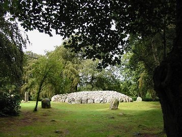
| "Today it is open to the elements, but originally it took a different form. The central chamber had a dome-shaped roof that rose to around three and a half meters. This was built entirely of overlapping stones closed by a single large slab." (quote from the table) | The North-east Passage Grave
surrounded by the standing stones and hanging birches. "On the shortest
day of the year the rear of the chamber is illuminated by the setting
sun. ... The monument probably contained burials but the record is
rather confused." |
 |
 |
|
The
Central Ring Cairn.
Text from the
information table is on the right.
|
"The original structure consisted of a rubble wall supported on both sides by a kerb. Both these kerbs were graded by height, with the lowest stones in the direction of the rising sun, and the tallest towards the south-west where the sun sets at midwinter." |
 |
 |
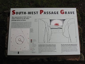
| Here the information table illustrates beautifully how the passage ways were built so as to point in the direction of the midwinter sunset. | The clouds were closing in as we were walking through the beech forest and getting to the last one of the three cairns, close to the open countryside, the South-west Passage Grave. Again, the opening is towards the midwinter setting sun in the south-west. |
 |
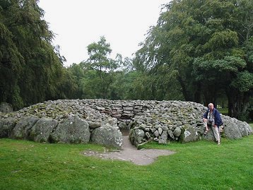 |
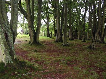
| A piece of beech forest which was well taken care of at this historic site - standing stones in the background, around the south-west passage grave which is behind the trees. | John is standing at the South-west Passage Grave. We can only imagine the burial chamber that was once in the center of this passage grave. |
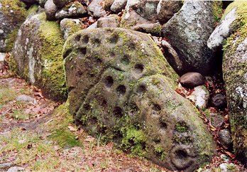 |
"One of the more spectacularly cup marked stones can be found around the back of the NE cairn" (Clava Cairns - Highland, Scotland - Passage Tombs, Ring Cairn and Stone Circles) |
As
we left the
Clava Cairns, the rain was starting more seriously. A whole busload of
tourists were just arriving and, once again, we had been very lucky to
get to the place just in time.
We arrived at Inverness airport in pouring rain, returned the car and caught our flight to London. It occurred to us that we had never seen this airport in anything but starkly pouring rain.
So on to Heathrow and then Lyon Saint-Exupéry. A missing bag at the Lyon airport that got traced to our house the next day was the only little hitch in a magically beautiful and eventful vacation.
We are certain to be back. If not next year, it will certainly be the year after. We still have to see the Hebrides - Skye, Lewis and Harris. And we would like to go back to some places we remember from this first trip as being particularly impressive or remarkable in one way or the other.
Go to Site map