Part 3
June 16
Map of northern Scotland & the Hebrides
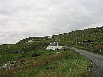
Leaving Scalpay and Harris for Lewis
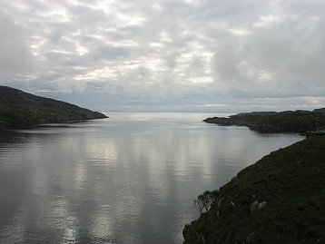 |
| A last look from Scalpay eastwards early in the morning, on the day we leave for Lewis. |
 |
 |
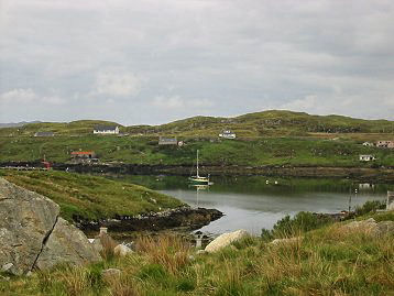
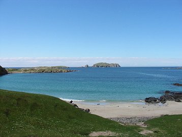
| Scalpay in the morning of June 16. View taken from just in front of Hirta House. |
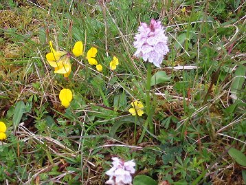
A detail of the field next to the road that was sprinkled with oodles of common spotted orchids and common bird's foot trefoil. |
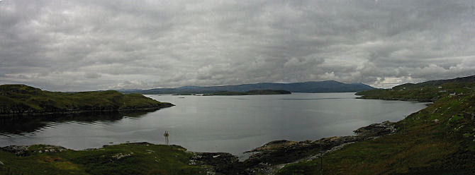 |
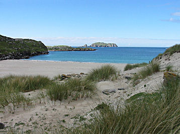
| A view of the sea to the east on the morning we are leaving Scalpay and Hirta House |
 |
 |
| This is Harris, the way we'll remember it, barren hillsides and quaint little white houses. | A rocky piece of coastline as we are leaving stony Harris for greener Lewis. |
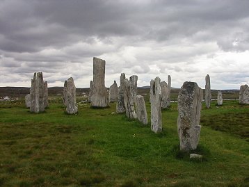
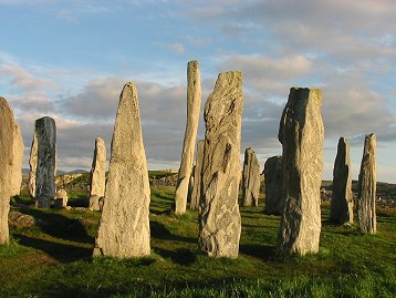
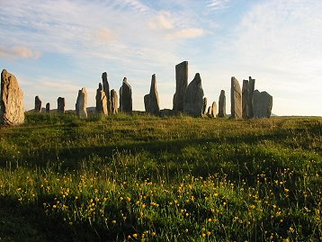
The standing stones at Calanais (Callanish) on the Isle of Lewis
From the web site Calanais Undiscovered Scotland
"The area around Calanais is home to over 20 monuments erected between 3000 and 4000 years ago. Most famous by far is Calanais I, a complex arrangement of some 50 stones. At their heart is a circle of 13 stones between 8 and 13 feet tall, surrounding the tallest stone on the site, 16 feet high and weighing in at about 5.5 tonnes. Some time later a stone tomb was added to the centre of the circle."
From the Calanais Visitor Centre - The 5000 year old Calanais Stones are one of the most famous landmarks in the Western Isles and are situated on the west side of the Isle of Lewis.
 |
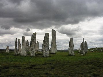 |
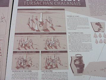
| This is the table showing the round setting of the stones and describing the use of it. "It was probably a burial chamber." and "It is thought to date to between 2000 or 1700 BC." There seems to have been a chambered cairn inside the ring of standing stones. An attempted reconstruction of the cairn is shown on the table. | Our first look at the stones at Calanais on this overcast day before we settle in at our new B&B close by. The highest stone is set inside the circle stones. |
 |
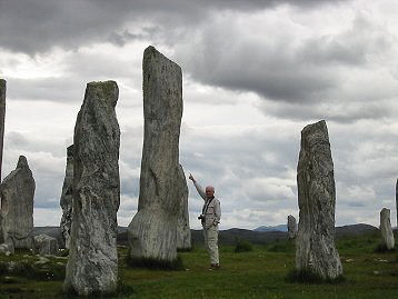 |
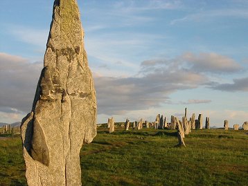
| As is shown here, there are a number of stones seemingly forming a passage way to the ring of stones. | John is showing the impressive size of the highest stone (16 ft), which is set inside the ring, but not centered. |
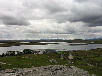 |
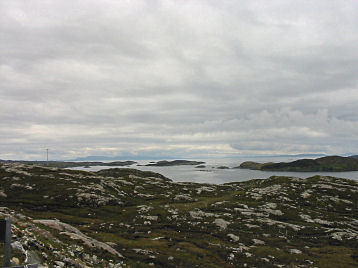
| View of Loch Roag from Calanais. From undiscoveredscotland.co.uk/lewis web site: "Loch Roag is the sea loch that bites deeply into the north west coast of Lewis, part of which envelops the island of Great Bernera. On the east shore of the loch the neck of a headland is home to the small linear settlement of Calanais, and, on a hump of land between the village and its jetty, the Calanais (or Callanish) Standing Stones." |
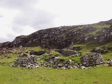
We drove on to the island of Great Bernera on the south side of Loch Roag to visit the vestiges of the late iron age village that was once at Bostadh Beach at the very tip of the island. The web site by Tim Neighbour and Jim Crawford shows us what the site looked like in 1993:
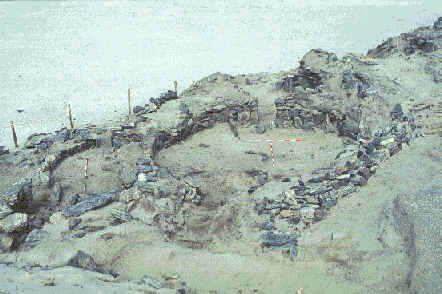 |
| "Preserved beneath the Norse levels, was a village of three Pictish `jelly baby' or figure-of-eight houses, filled with windblown sand and in-situ floor deposits. The village is thought to date from the mid to late 1st millennium AD. The houses shared a number of common architectural features. Essentially they were stone built structures with southern entrances, a central cell and at least one annex. They were designed to be largely subterranean: a sensible response to living in an unstable sand dune system, and as a consequence the walls survived to their full height." (from the same web site) |
Quote from web site:
"In the spring of 1993, after a prolonged period of gales and high tides, there was storm surge around the Isle of Great Bernera, which sculpted a new face to the dune on the east of Bostadh Beach. A series of stone structures were exposed within this new face.
Rescue excavation, funded by Historic Scotland, was carried out by the Centre for Field Archaeology (CFA), University of Edinburgh under the direction of Tim Neighbour. Initially scheduled for four weeks in March 1996, the complexity of the site and the extraordinary state of preservation of the buildings and artefacts led to funding being provided for 13 weeks in total, spread over three seasons in 1996."
Today, there is not much left of the ring shaped structures.
 |
 |
| Not much can be seen today of what was in 1993 clear remnants of ancient houses. Later storms have covered over with sand most of what was visible then. | View out to the sea from Bostadh Beach. (Might the name Bostadh Beach come from the Scandinavian word 'bostad' = living quarters?) |
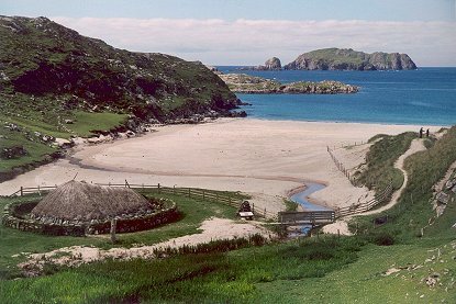
Just above the beach, there is a replica Iron Age house open to the public. A picture of the replica and also a couple of the remnants of other iron age houses higher up in the glen can be seen in the picture at the geograph.co.uk web site
 |
 |
|
Bostadh beach, Great Bernera (geograph.co.uk)
Under
this beach are the remains of an Iron Age village, re-covered with sand
after being studied by archaeologists so as to preserve it. In front of
the beach is a replica Iron Age house open to the public. At the right
hand side of the image can be seen the corner of the modern cemetery.
|
Our own picture of the reconstructed Iron Age house, where we spent a good long time with a woman guide and a couple of interesting and knowlegeable visitors. There was a homey-looking fire in the hearth in the middle of the room and she explained what the various nooks and alcoves might have been used for. |
 |
We have not found any facts or theories of the age of the remnants of houses we found in the glen above the mostly disappeared iron age village down by the bach. A theory is that the big landlords chased out poor farmers, the crofters, who had to go to wherever they could find a place to build their houses and graze their cattle, probably sheep in most cases. |
| More remnants of an old house and a view out towards the sea from this pleasant but boggy glen. | 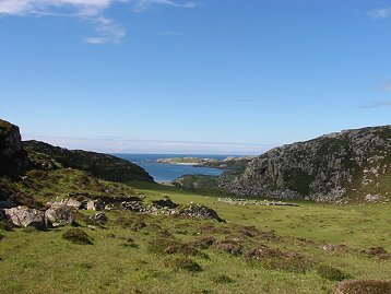 |
Pictures of the Standing Stones in the evening sun after dinner at our B&B.
June 17
Driving north to the Butt of Lewis - with several fascinating stops on the way.
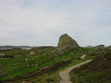
On the way up north we first stopped by at the Dun Carloway Broch, situated close to the mouth of Loch Roag, which we had driven around the day before.
"Dun Carloway was probably built some time in the last century BC (iron age). It would have served as an occasionally defensible residence for an extended family complete with accommodation for animals at ground floor level. It would also have served as a visible statement of power and status in the local area." (Undiscovered Scotland)
We also visited Gearrannan Blackhouse village on our way up north. It sits right on the Atlantic on the west coast of Lewis.
Walk at the Butt of Lewis lighthouse
Go to Scotland - Part 4
 |
The weather has improved immensely before sunset and here is a sunny picture of the inner circle with the highest stone (16 ft) inside the ring. |
| The Standing Stones in 'Gegenlicht' towards the setting sun. | 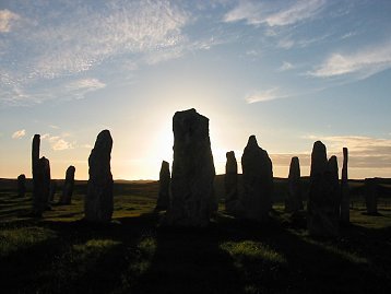 |
 |
 |
| The inner formation in the setting sun behind a field of marsh marigolds. | One of the giants outside the inner circle |
June 17
Driving north to the Butt of Lewis - with several fascinating stops on the way.
On the way up north we first stopped by at the Dun Carloway Broch, situated close to the mouth of Loch Roag, which we had driven around the day before.
"Dun Carloway was probably built some time in the last century BC (iron age). It would have served as an occasionally defensible residence for an extended family complete with accommodation for animals at ground floor level. It would also have served as a visible statement of power and status in the local area." (Undiscovered Scotland)
 |
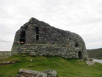 |
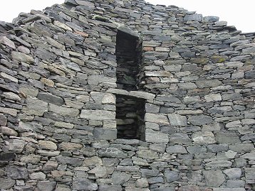
| The broch seen from the approach path. We were lucky to arrive just before a busload of tourists. The broch overlooking Loch Roag was surrounded by sheep and a piece of old wall. | The broch seen from the north. Dun Carloway, or Dun Charlabhaigh, is a remarkably well preserved broch in a stunning location overlooking Loch Roag on the west coast of Lewis. (Undiscovered Scotland) |
 |
 |
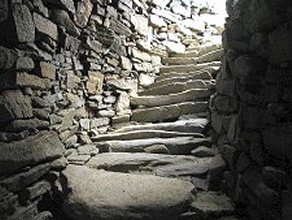
| Stairway Within the Walls - picture from Undiscovered Scotland |
Detail from the highest wall inside the broch - windows leading to the open area with the stairway in between the two walls. |
We also visited Gearrannan Blackhouse village on our way up north. It sits right on the Atlantic on the west coast of Lewis.
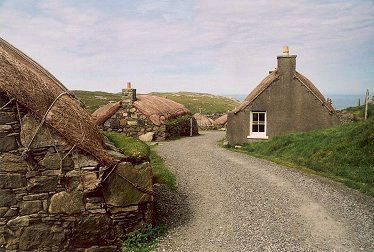 |
Facing the Atlantic lies the blackhouse village of Gearrannan, an evocative port of call for anyone trying to understand a way of life once very common on Lewis. This is a unique place in a beautiful environment. (Undiscovered Scotland) |
|
Although people lived in this area of western Lewis in the Iron Age, as witnessed by
nearby Dun Carloway, "modern" settlement here dates back to
the 1600s. For over three hundred years people eked out a living here; lived, die, paid their
rents, or were quickly evicted if they didn't. The 1886 Crofting Act gave crofters a security of
tenure they had never had before and patterns of living and farming changed as a result. The
blackhouses you see in Gearrannan today, though seeming much older, date back only to the end of
the 1800s. (Undiscovered Scotland) |
 |
 |
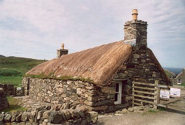
One of the blackhouses had been fully equipped the way it once was a couple of hundred years ago. |
Walk at the Butt of Lewis lighthouse
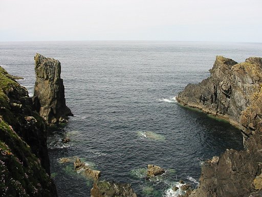 |
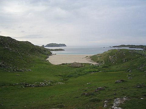
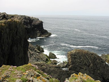
| Arriving at the Butt of Lewis with beautiful scenery, rocks, sea and moors inside the edge of the cliffs. |
 |
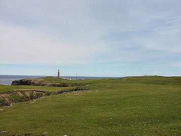 |
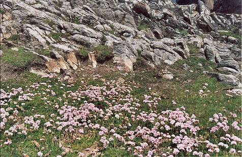
| The first inlet we passed by on our short walk on the moors. The cliffsides were spotted with shags and gannets, some sitting absolutely motionless in an eerie way. Sea pinks or thrift (armenia maritima) in the forground. | Wide and sometimes boggy moors covered with small flowers, marsh marigolds and buttercups, at the top of the cliffs. |
 |
| Oodles of sea pinks (or thrift) up among the rocks and moors at the Butt of Lewis. |
Go to Scotland - Part 4