New Mexico - 2
The Bandelier National Monument
"Best known
for mesas, sheer-walled canyons, and
several thousand ancestral Pueblo dwellings found among them, Bandelier
also includes over 23,000 acres of designated Wilderness. The
best-known archeological sites, in Frijoles Canyon near the Visitor
Center, were inhabited from the 1100s into the mid-1500s, and earlier
groups had used the area for thousands of years. The park was named for
Adolph Bandelier, a 19th-century anthropologist. Proclaimed on February
11, 1916." (National
Park Service)
Left: Condition of the trails in the park prior to 1933
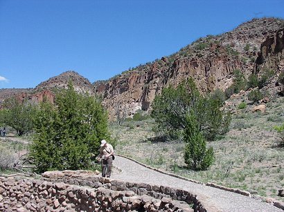
"Bandelier National Monument is located in the transition area between the Chihuahuan and Great Basin deserts of north-central New Mexico. It is situated on the Pajarito Plateau, between the Jemez Mountains on the west and the Rio Grande River on the east.
The Pajarito Plateau was created from volcanic lava and ash flows which erupted from nearby Jemez Volcano, about a million years ago."
(Desert, USA - Setting)
About 1500, with the emergence of the Spanish into the Desert Southwest, the residents left the canyon, never to return. Their descendants probably lived in Cochiti and San lldefonso pueblos a few miles east on the Rio Grande River." (Desert, USA - Cultural History )
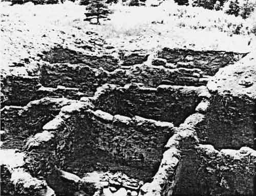
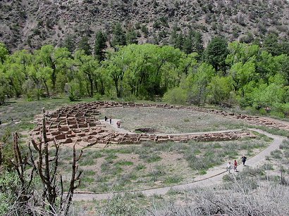
Left: Exposed ruins of Tyuonyi
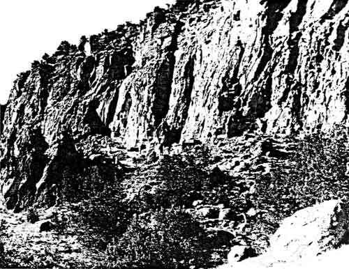
"The erosion of the soft volcanic rock called tuff created natural caves, which the Anasazi then enlarged to create living and ceremonial spaces." (Bandelier National Monument)
Left: Condition of the trails in the park prior to 1933
From: Illustrations at the Bandelier National Park site
"Bandelier National Monument is located in the transition area between the Chihuahuan and Great Basin deserts of north-central New Mexico. It is situated on the Pajarito Plateau, between the Jemez Mountains on the west and the Rio Grande River on the east.
The Pajarito Plateau was created from volcanic lava and ash flows which erupted from nearby Jemez Volcano, about a million years ago."
(Desert, USA - Setting)
Native Peoples
"Several thousand years ago, the Pajarito Plateau was used by mobile Paleo-Indian hunters, and later by Archaic hunter-gatherers, who wandered through the canyons seeking game and wild plants.
About 2,000 years ago, small family groups of Anasazi moved into the canyon occupying pit houses and cultivating corn, beans and squash. Pottery, and architecture slowly evolved in this region as it did throughout other Anasazi locations in the Southwest, but people continued living in small scattered settlements of one or two families.""In
the 13th century, the Anasazi
constructed Tyuonyi, the circular two-story Pueblo in the bottom of
Frijoles Canyon, just behind the Monument's Visitor Center. This
high-walled village boomed in the 15th century, housing as many as 100
people.
About 1500, with the emergence of the Spanish into the Desert Southwest, the residents left the canyon, never to return. Their descendants probably lived in Cochiti and San lldefonso pueblos a few miles east on the Rio Grande River." (Desert, USA - Cultural History )
Left: Exposed ruins of Tyuonyi
From: Illustrations at the Bandelier National Park site
"The erosion of the soft volcanic rock called tuff created natural caves, which the Anasazi then enlarged to create living and ceremonial spaces." (Bandelier National Monument)
"Trails through this once-mighty
city make this trip a highlight; climb the ladders to sky-scraping
Ceremonial Cave" (this addition to the Tyuonyi loop
trail being closed around the time we
were there).
"Pale and pockmarked canyon walls plunging into lush, narrow valleys would have marked this land for preservation even without the beautiful and well-preserved Puebloan Indian ruins, occupied between 1150 and 1550." (Santa Fe and Taos - Lonely planet)
"Pale and pockmarked canyon walls plunging into lush, narrow valleys would have marked this land for preservation even without the beautiful and well-preserved Puebloan Indian ruins, occupied between 1150 and 1550." (Santa Fe and Taos - Lonely planet)
 |
 |
| Tyuonyi
Pueblo Ruins "This pueblo is named Tyuonyi which translated means “Meeting Place.” It is just a short walk from the visitor’s center. It had at least two stories and over 400 rooms, and was inhabited for an estimated 400 years ending in the mid-1500s." (from site: www.pigseye.com) |
Siv standing here looking at the map of the site; the remains of the Tyuonyi pueblo in the foreground and the mountain with the ancient cliff dwellings in the background. |
 |
 |
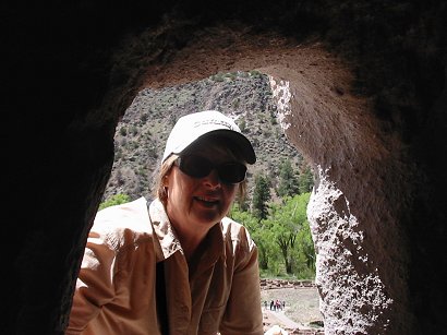
| Siv
looking into a cave where John is taking the picture |
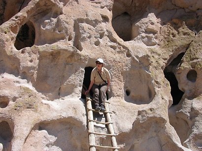
... and
here climbing down the ladder from the same cave room |
 |
 |
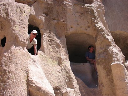
| John
looking out from one of the cave rooms where you could barely
stand upright. Philippe can barely be seen in the shade at the other
opening. |
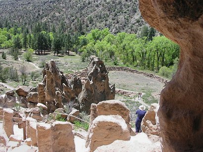
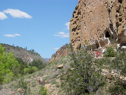
View
over the valley from the interior of one of the caves. Wild formations
below. Behind, in the valley, is the
Tyuonyi pueblo once again in
view. |
 |
 |
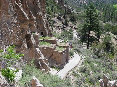
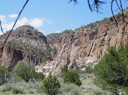
| The
well-marked trail loops around the talus houses, the
reconstructed ruins below the cliff
houses |
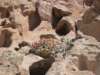
Blooming cactuses in the volcanic tuff - possibly cane cholla. |

Left: The road from the mesa top is
visible, as are the temporary structures of the CCC camp.
Emergency Conservation Work--Civilian Conservation Corps
"Probably the most popular emergency relief work program in the 1930s was the CCC, one of President Roosevelt's pet projects that received top priority in the early New Deal period. The leaders of the National Park Service recognized that the CCC was a potential bonanza for the national parks Horace Albright, who represented the Department of the Interior on the CCC advisory council, put considerable effort into getting the program started in the spring and summer of 1933."
From: Illustrations at the Bandelier National Park site
The talus houses are well visible
in the middle of the above picture from the National Park Service.
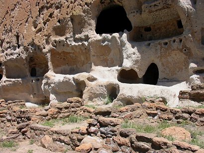 |
 |
| Close-up of the remains of living quarters on the ground below the cliff dwellings constructed in the volcanic tuff | View (from farther off) of the side of the cliff with remains of the 'talus houses' built at the base of the cliff |
 |
 |
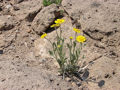
| Compositae
flowers on the hillside - possibly yellow oxe-eye |
Looking back to where we came from |
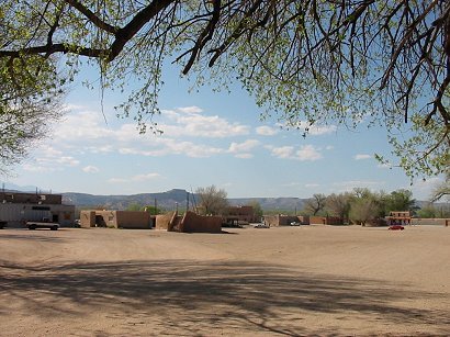
San Ildefonso Pueblo
San Ildefonso Pueblo in New Mexico Magazine
"Located 23 miles (37 km) north of Santa Fe via U.S. 84/285 then west off N.M. 502, the contemporary San Ildefonso Pueblo is a flourishing art community."
"Since the early 1900s, this Tewa village has been the center of the Pueblo arts revival."
"The ancestors of the San Ildefonso people abandoned their original villages of Mesa Verde and Bandelier due to drastic changes in the environment. It was on top of nearby Black Mesa that San Ildefonso, along with other Pueblo people from the area, successfully held off Spanish soldiers, who laid siege on the natural stronghold during their reconquest of New Mexico in 1694." (New Mexico Magazine)
"The pueblo was founded in the 1300s by settlers who had abandoned Bandelier in the wake of a long-term drought."
(Santa
Fe and Taos - Lonely planet)
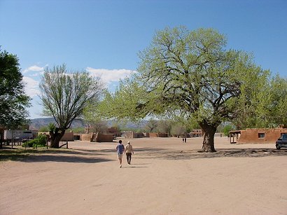 |
 |
We are on our way to visit the Ildefonso Pueblo |
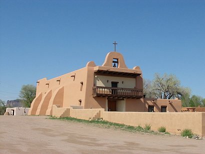
And of
course there is the obligatory church, built in fresh adobe. |
 |
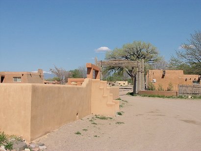 |
On our way out from this neat-looking pueblo |
The entrance to the pueblo, a mixture of fresh adobe and weathered wood |